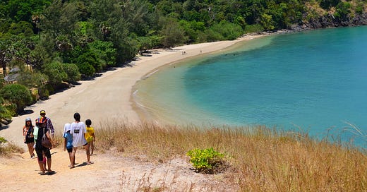
T.I.C.D.: Mu Ko Lanta & Ko Haa
The entire Lanta archipelago and a fistful of more distant isles, condensed.
Welcome back to the Thai Island & Coastal Directory, a book-in-progress that promises to be the most complete guide to coastal Thailand ever written in English, covering more than 800 islands and all 24 coastal provinces. I’m releasing it piecemeal (four sections monthly) here at Thai Island Quest.
For info on how to use the T.I.C.D. and a working Table of Contents, paddle here. To view all previously published sections, see the welcome page.
T.I.C.D. ticker: So far, we’ve covered 516 islands and 166 notable mainland areas in 35 sections, including this one.
Resuming Krabi province…
This section covers the many islands found in the far S corner of Krabi.
Mu Ko Lanta
The Lanta archipelago contains 35 islands and extends for some 45 km from top to tail, with its two main islands — Ko Lanta Yai and Ko Lanta Noi — forming the W side of the scenic bay of Ao Lanta. The archipelago is the subject of its own namesake NP and administrative district, which also includes Ko Klang to the N and is one of only 10 districts in Thailand that are entirely composed of islands.
Note that Mu Ko Lanta, as far as I define it, includes Ko Lanta Yai / Noi along with their immediate satellites and the isles set further out in Ao Lanta. While I don’t include Ko Ma, Ko Haa, Ko Ngai or Ko Rok as part of the Lanta archipelago, they are also part of Mu Ko Lanta NP and accessible from Ko Lanta Yai. (Ko Ma and Ko Haa are covered below, and Ko Ngai and Ko Rok are covered with the Trang islands.)
Those who fully explore Mu Ko Lanta will find significant geographical variation. Jungle-cloaked mountains fill Ko Lanta Yai’s belly. Mangrove forest sprawls across the watery reaches between Lanta Yai and Ko Lanta Noi. Caves dot the karst massifs found in the S of Lanta Yai and on Ko Talabeng to the NE. Lanta Yai also has at least 18 beaches, even if the rising sea level is badly eroding some of them.
Ko Lanta Yai is one of eight Thai islands that I classify as “large islands,” and one of only 10 that I consider to be “primary tourism islands.” While its NW corner has all the marks of mass tourism, much of Lanta Yai remains sleepy and is still considered a lower-key alternative to Phuket and Ko Phi Phi. The island has a great balance as far as the vibe goes, with the vibrant N area tempered by quieter S reaches.
Traditional Thai Muslim ways of life still endure on parts of Ko Lanta Yai and virtually all of Ko Lanta Noi, the arcadian mid-size island that is linked to its larger sibling by the Sri Lanta Bridge. A few homestays and tiny resorts are found on Lanta Noi as well as Ko Por and Ko Bubu further E, but nearly all visitors stay on one of the lengthy beaches that grace the W coast of Ko Lanta Yai.
This well-known island also hosts many scuba outfits running trips to the dozens of coral sites found relatively far to the W and SW, such as Ko Haa, Hin Mueang and Hin Daeng. Lanta-based dive boats also hit sites in Mu Ko Phi Phi.
Ko Lanta Yai’s location between the C and S Andaman coastal zones make it easy to include in a broader trip. From here, ferries and/or day-tour boats ply S to Ko Ngai, Ko Mook, Ko Rok and beyond; W to Ko Haa and Ko Phi Phi; N to Ko Jum / Pu and the Krabi coast; and E to Ko Por, Ko Talabeng and the rest of Ao Lanta.
The archipelago is also the ancestral home of the Urak Lawoi, traditionally semi-nomadic “sea people” who settled Ko Lanta Yai centuries ago.
Islands below are arranged from W to E, then N to S.


