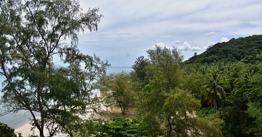
T.I.C.D.: Lower Songkhla coast & islands
Notable areas south of the Lake region in this large province, condensed.
Welcome back to the Thai Island & Coastal Directory, a book-in-progress that promises to be the most complete guide to coastal Thailand ever written in English, covering more than 900 islands and all 24 coastal provinces. An upgrade of $5 USD monthly gets you the T.I.C.D. and many other in-depth articles.
T.I.C.D. ticker: So far, we’ve covered 781 islands and 231 notable coastal areas in 45 sections, including this one.
(To view all previously published sections, see the welcome page or the working Table of Contents — or click T.I.C.D. from the homepage menu.)
Resuming Songkhla province…
Songkhla covers a broad swathe of terrain in the central stretch of the Deep Southern Gulf coastal zone. Its N seacoast and share of the Songkhla Lake region joins another 70 km of coastline further S, down in a land of many mosques that introduces the only region of Thailand with a majority ethnic-Malay population.
Lower Songkhla hosts 7 obscure islands, though the miles-long and virtually empty mainland beaches will be of more interest to most. In the relaxing Chana and Thepha districts, the beaches give way to estuaries sprinkled with many humble villages that draw sustenance from both sea and river.
Songkhla’s lower half also includes a rugged 120-km border with Malaysia’s Kedah and Perlis states. Trains, buses and vans shoot travelers in and out of Thailand via the border crossings at Padang Besar and Dannok, two of the many towns accessible from the major transport hub of Hat Yai. With a population of some 400,000 in its metro area, Hat Yai is the largest city in Southern Thailand.
In fact, Songkhla province is so big that the far W reaches of this 7,394-sq.-km province are much closer to the Andaman Sea than the Gulf of Thailand. Some of Songkhla’s far-flung NW areas are more closely linked with the Andaman-coastal province of Satun than Mueang Songkhla, or even Hat Yai.
The remote W and S reaches host Songkhla’s major protected areas. Ton Nga Chang Wildlife Sanctuary is named for one of the more impressive waterfalls in Southern Thailand, while the Khao Nam Khang National Park has a network of tunnels built by an armed Communist insurgency that was active throughout much of Thailand in the 1970s and ‘80s. San Khala Khiri National Park is notably remote down on the Yala border, while some of Songkhla’s many other waterfalls, such as Boriphat, are contained by their own forest parks. There is also a coastal wildlife sanctuary, Khao Pachang - Laem Kham, plus some undeveloped barrier isles amid the Hutan Simpan Nong Chik Forest Park, which is shared with Pattani. Near Satun and Perlis, a chunk of Thale Ban National Park also falls within Songkhla.
While Hat Yai and other N areas of Songkhla have not been subject to frequent violence from the armed insurgency, a Malaysian tourist was among three killed when a hotel in Hat Yai was bombed in 2012. Violence has been more common further S in Songkhla near the border, for example in Sadao district where the Thai railway has been targeted in recent years. I’m personally comfortable with traveling the seacoasts and jungle areas of lower Songkhla province, but — as with Pattani, Narathiwat and Yala further S — travelers should understand the risks.
Outside Hat Yai, expect little to no English to be spoken in these parts.

Coastal areas and islands below are arranged roughly from N to S.


