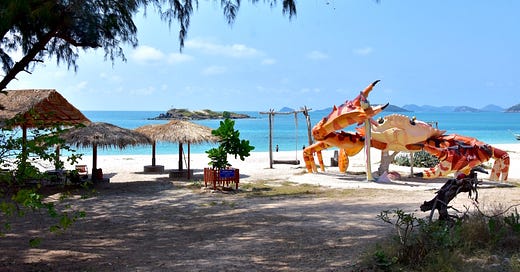
T.I.C.D.: Mu Ko Samae San, Ko Khram & Ao Sattahip group
Most of the Navy-controlled islands of Sattahip district, condensed.
Welcome back to the Thai Island & Coastal Directory, a book-in-progress that promises to be the most complete guide to coastal Thailand ever written in English, covering more than 800 islands. For info on how to use the T.I.C.D. and a working Table of Contents, paddle over here. Thank you for reading!
T.I.C.D. ticker: So far, we’ve covered 320 islands and 68 notable mainland areas in 21 sections, including this one.
Entering Chonburi province…
The ‘Ocean City’ province has around 50 islands in total, comprising more than two thirds of all the islands in the Upper Gulf coastal zone.
Most of the travelers who visit this province, including many weekenders from Bangkok in the northwest, stick to the popular beach towns of Bang Saen and Pattaya, perhaps visiting the popular islands of Ko Larn and Ko Si Chang. Often overlooked is the province’s southernmost district, Sattahip, which borders Rayong province to the east and contains 34 islands all by itself.
The barely developed nature of these islands is a result of Royal Thai Navy control. While the Navy uses some islands for training purposes, others are open for leisurely day trips. Many foreigners avoid them due to the Naval presence and a loosely enforced rule, at least for Ko Samae San, that a Thai must accompany all foreign visitors. No other Thai islands come with this peculiar setup.
Sattahip’s islands also feature several dive sites, including two shipwrecks, with Mu Ko Samae San hosting the lion’s share of the reefs and a World War II period wreck. Note that while dive and snorkeling boats are permitted to anchor off islands that are not used for Naval exercises, access to the beaches on some islands is strictly limited or closed for environmental protection and research.
Islands below arranged roughly from NW to SE.


