T.I.C.D.: Chanthaburi coast & islands
All of coastal Chanthaburi province and its 11 isles, condensed.
Welcome back to the Thai Island & Coastal Directory, a book-in-progress that I expect to be the most complete guide to coastal Thailand ever written in English, covering more than 800 islands. For info on how to use the T.I.C.D. and a working Table of Contents, paddle over here. Thank you for reading!
Entering Chanthaburi province…
Chanthaburi provincial coast, offshore islands & inland reaches
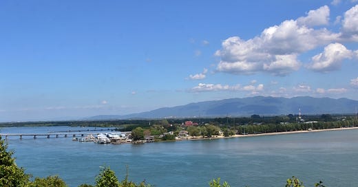
The scenic coastline of Chanthaburi province extends for roughly 110 km between Rayong in the west and Trat in the east, making it the centerpiece of Thailand’s Eastern Gulf coastal zone.
Off the shores of “Chan” are 11 islands: one small island, 6 islets, one speck and 3 estuary islands. None of these draw many travelers — especially foreign ones — but we’ve had some truly wonderful experiences visiting a few of them.
The Chan coast is known among Thais as a cycling and road-trip destination thanks to Thanon Chalerm Burapa Chollathit, a coastal road with impressive bridges spanning two major estuaries — and some switchback turns leading visitors up to the viewpoints that crown 4 different capes. It is as cool as it sounds.
The one coastal body of water that is not traversed by a bridge is Ao Kung Krabaen, a calming, mangrove-rimmed bay that is, along with Hin Chompoo (‘Pink Rock’), part of the small Kung Krabaen Wildlife Sanctuary. (Sadly, the last of the Eastern Gulf dugongs that this sanctuary was meant to protect is thought to have died in 2016.)
One other protected coastal area, Laem Singh Forest Park, covers some tree-studded hills tumbling down to Ao Krathing, a beach hidden along the shores of the park’s namesake cape, as well as Ko Nom Sao off its shores.
Chanthaburi province also has three inland national parks: Nam Tok Phlio, Khao Khitchakut, and, in the distant north of this beautiful 6,338-sq. km province, Nam Tok Sip Ha Chan; as well as Khao Soi Dao Wildlife Sanctuary covering sizable tracts of mountainous wilderness up near the Cambodia border. Plenty to explore.
(This section is part of a free early-release chapter of the Thai Island Directory. To access all six forthcoming chapters as they are published, and plenty more from Thai Island Quest, welcome aboard for $5 USD per month.)
Tha Mai & Na Yai Am district coasts
In this geographically distinctive portion of coastline, an 8-km-long arm of land extends between two sheltered bodies of water: the 4-km-wide Ao Kung Krabaen to the west, and a brackish 3-km-wide portion of Pak Nam Wang Tanot in the east. On the southern coast of this terrain is Hat Chao Lao, one of the two best-known beaches in Chanthaburi (the other being Hat Laem Singh).
Directly to the east of Hat Chao Lao, the pinky-finger-like Laem Hin Chompoo and its namesake pinkish-reddish stone cliffs join Ko Chong Saba to reach 2 km into the Gulf. Back over on the west side of Ao Kung Krabaen, 1-km-long Hat Kung Wiman extends toward another cape, topped by a viewpoint. If coming from Hat Chao Lao, reaching this western area requires heading inland for some 6 km, around the N side of the bay.
Hat Chao Lao / Ao Kung Krabaen
Size & status: 8-km-long beach / 4-km-wide bay
Location: 20-25 km SW of Mueang Chanthaburi
Topography: Fair beach (Hat Chao Lao); Scenic bay (Ao Kung Krabaen); Mangrove forest; Aquaculture; Some mountains
Inhabitation: Mid-level tourism; Fishing villages; Wildlife sanctuary station
Transport: Songthaew; Bicycle & motorbike rental; Steep roads (to Noen Nang Phaya Viewpoint)
Vibe: Family-friendly; Ecotourism (Ao Kung Krabaen); Primarily domestic travelers; Busy on Thai holidays; Locals at sunset; Minimal nightlife
Facilities: Lodgings (40+); Small bungalows; Independent restaurants; Markets & shops; ATMs
Activities: Aquarium, mangrove walkway, boat trips & kayaking (Ao Kung Krabaen); Viewpoint (Noen Nang Phaya); Hiking (Hin Chompoo); Cycling
Look for: Oysters & other seafood
Pak Nam Khaem Nu / Laem Hin Chompoo: Estuary / Cape | Directly E of Hat Chao Lao | Mangroves; Red-stone cliffs & broad seaside cliffs (Hin Chompoo); Aquaculture | Wildlife Sanctuary station; Scenic fishing village (Ban Pak Nam Khaem Nu) | Lodgings (10+); Homestays; Camping (Hin Chompoo) | Quiet; Expect little to no English to be spoken | Boat trips; Hiking (Hin Chompoo) | Look for: Wat Pak Nam Khaem Nu (“The Blue Temple”)
Ko Chong Saba: Islet | 300 m S of Hin Chompoo | Pink-stone coast; Tiny beach; Forested | Minimally inhabited (fishing shacks) | No facilities
Ko Nok Yai: Estuary island | Within Pak Nam Wang Tanot | Mangroves; Aquaculture | Minimally inhabited | No facilities
Laem Singh coast
The quiet central stretch of Chanthaburi’s provincial coast has some tourism facilities but draws considerably fewer overnight visitors than Hat Chao Lao.
The name Laem Singh, meaning ‘Lion Cape,’ is used for a specific cape as well as a nearby 5-km-long beach — and an entire district boasting some 45 km of coastline. Much of the district is a watery land of aqua-farms and the many branching fingers of the Chanthaburi River as they mingle with the seawater.
Laem Singh / Pak Nam Chanthaburi
Size & status: Cape / Estuary
Location: 20 km S of Mueang Chanthaburi & 20 km E of Hat Chao Lao
Transport: Songthaew (to/from Mueang Chanthaburi)
Topography: Fair to good beaches (Hat Laem Singh; Ao Krathing); Cove (Ao Yang); Estuary (Pak Nam Chanthaburi); Aquaculture
Inhabitation: Mid-level tourism; Forest park station (Ao Krathing); Fishing villages (Ban Ao Mu, Ban Sa Kao)
Facilities: Lodgings (10+); Camping (Ao Krathing); Independent restaurants; Markets & shops; Public park (Hat Laem Singh)
Vibe: Low-key; Family-friendly; Historical; Wats & shrines; Seafood destination; Primarily domestic travelers; Preferred by long stayers; Minimal nightlife
Activities: Cycling; Road trips; Kayaking & hiking (Ao Krathing); Boat trips (Ko Chula; Ko Nom Sao; Pak Nam Chanthaburi); Viewpoints (Laem Singh); Sightseeing (Phairi Phinat Fort; Tuk Daeng & Khuk Khi Khai; Laem Singh Lighthouse
Look for: Krajud (grass mats); Pu nim (soft-shell crab)
Ko Chula: Islet | 2 km off Hat Laem Singh | Small beach; Rocky; Forested | Minimally inhabited (beach shack) | No facilities | Kayaking
Ko Nom Sao: Islet | 3 km off W coast of Laem Singh | Small beach; Rocky; Forested | Uninhabited; Part of Laem Singh Forest Park | Kayaking
Nong Bua & Ko Maew
These can be thought of as the outer areas of Laem Singh district to the N and E. Expect quietude and a local flavor in these rural coastal reaches.
Nong Bua / Ko Samet Ngam: Small town / Estuary island | 8 km S of Mueang Chanthaburi & 12 km N of Hat Laem Singh | Songthaew | Brackish rivers; Mangroves; Agricultural (krajud grass); Aquaculture | Low-level tourism; Old town (Nong Bua) | Homestays; Markets | Historical; Wats & shrines; Expect little to no English to be spoken | Sightseeing (King Taksin Shipyard; Chanthaburi Grand Canyon) | Look for: Khanom wan (Thai sweets) in Nong Bua
Ban Ko Maew: Coastal villages | 4-12 km E of Hat Laem Singh | Aquaculture | Low-level tourism; Small-scale fishing | Lodgings (5+); Small restaurants | Wats & shrines
Ko Nu: Speck | 200 m off Ban Ko Maew | Rocky | Uninhabited
Ko Phroet & its islets
Three ko’s, but only two actual islands.
Ko Phroet: Small cape | 25 km S of Mueang Chanthaburi | Limited to no local transport; Pier; Private boat rental | Scenic bay; Hills; Large cliffs; Aquaculture | Fishing village; Low-level tourism | Lodgings (5+); Homestays; Small eateries & cafes | Offbeat travel; Expect little to no English to be spoken; Primarily domestic travelers; Wats & shrines | Boat trips; Kayaking; Viewpoint
Ko Kwang: Islet | 1.5 km SE of Ko Phroet | Small beach; Small cliffs; Forested | Minimally inhabited; Shrine | No facilities | Kayaking
Ko Ram: Islet | 2 km W of Ko Phroet | No beaches; Rocky | Uninhabited
Khlung, Pak Nam Welu & Ko Jeek
The easternmost district in Chanthaburi province, Khlung is the primary gateway into Pak Nam Welu, a roughly 200-sq. km wetland area that has largely been given over to aquaculture, with various types of crab being a local specialty. (The other entry points to Pak Nam Welu are in Saen Tung and Ban Ang Kapong, both over in Trat province a little further east.)
Small numbers of domestic travelers arrange boat trips into the wetlands to dine at one of the stilted restaurants or experience the homestays. A bit further out, off the mouth of the Welu, Ko Jeek lies within clear view of Ko Chang and delivers a similarly out-of-the-way, fishing-focused vibe. A charming area overall.
Khlung: Small city; District center | 25 km SE of Mueang Chanthaburi & 40 km NW of Mueang Trat | Interprovincial bus stop; Songthaew; Small piers | Urban; Aquaculture; Mangroves | Lodgings (5+); Markets & shops; Restaurants & street food; Banks & ATMs | Seafood destination (Farm Pu Nim); Expect little to no English to be spoken | Boat trips | Look for: Crab & other seafood
Rai Pan Din: Settled wetland area | SW of Khlung | No road access; Small boat travel only | Aquaculture | Village; Low-level tourism | Homestays; Restaurants | Seafood destination; Out of the way; Primarily domestic travelers; Community-based tourism; Expect little to no English to be spoken | Look for: Dried shrimp
Ko Bang Chan: Estuary island | 15 km S of Khlung & 12 km N of Tha Ang Kapong | No road access; Small boat travel only | Brackish rivers; Aquaculture; Mangroves | Stilted fishing village; Low-level tourism | Homestays; Restaurants; Shrines | Remote; Primarily domestic travelers; Expect little to no English to be spoken
Ko Jeek Nok / Klang: Alt. sp.: ‘Chik’; ‘Jik’ | Small island / islet; Largest island in Chanthaburi province (Nok) | 2 km off mouth of Welu River; Southernmost point in Chanthaburi province (Klang) | Accessible by private boat from Tha Ang Kapong | Small beach; Shell beach; Coves; Small cliffs; Rolling forest; Agricultural (rubber, fruit) | Low-level tourism; Fishing village; Shrines; Lighthouse; Chinese cemetery on Klang | Piers; Narrow lanes; Minimal traffic; Foot trails | Homestays; Small eateries; Little shops; No ATM | Family-friendly; Community-based tourism; Close-knit; Offbeat travel; Expect little to no English to be spoken | Kayaking; Hiking | Look for: kuay thiao muu liang (Chanthaburi pork noodles)
Notable inland reaches of Chanthaburi
Come for the coast. Stay for the mountains. And, don’t forget the old town!
Mueang Chanthaburi (‘Chanthaburi town’)
Size & status: Mid-size city; Capital of Chanthaburi province
Location: Center of the province & 20 km N of the Laem Singh coast
Transport: Interprovincial bus terminal; Songthaew; Limited car & motorbike rental
Topography: River town; Agricultural (Durian & other fruits on outskirts)
Inhabitation: Mid-level tourism; Old town & heritage architecture
Facilities: Lodgings (30+); Many independent restaurants, bars & shops; Street food; Shopping centers & markets (Talay Ploy; Talad Sod; Talad Chatuchak); Banks & ATMs; Public parks
Vibe: Historical; Wats & shrines; Coffee by the river; Community-based tourism (Chanthaboon old town); Primarily domestic travelers; Some nightlife; Culinary scene
Activities: Boat trips (Chanthaburi River); Sightseeing (Cathedral of the Immaculate Conception; Maritime Museum / Noen Wong Fort; Wat Khao Ploi Waen; Wat Phlap; Wat Mangkon Buppharam (Wat Leng Hua Yi)
Look for: Muu chamuang (rich pork curry with local sour leaf); Kuay chab yuan (Vietnamese-style pepper-pork noodles); Durian & other fruits (Fruit Festival yearly in May)
Khao / Namtok Phlio: Small mountainous jungle area / waterfall; National park land | E of Mueang Chanthaburi (HQ & Namtok Phlio 2 km N of Sukhumvit Highway) | Good waterfalls (Phlio; Tok Trong; Khlong Narai) | NP HQ, restaurant & camping (Namtok Phlio; Namtok Tok Trong) | Very popular with domestic travelers (Namtok Phlio); Historical | Hiking; Bird-watching; Sightseeing (Alongkorn Chedi)
Khao Khitchakut / Khao Soi Dao: Large mountainous jungle area (up to 1,085 m); National park / wildlife sanctuary land (Khao Khitchakut NP; Khlong Soi Dao WLS); Forest temple land (Wat Phluap) | Begins 30 km N of Mueang Chanthaburi; Covers most of N part of Chanthaburi province | Minimal to no public transport | Fair to great waterfalls (Krathing; Khlong Phaibun) | Mountaintop shrine (Phra Phutthabat) | NP HQ, restaurant & camping (Namtok Krathing) | Remote | Hiking; Mountain trekking (Pha Hin Koob out of Ban Thung Pel); Wildlife interest; Mountaintop Buddhist pilgrimage (Phra Phutthabat yearly around March)
Pong Nam Ron: District | Begins 50 km NE of Mueang Chanthaburi; Along border with Cambodia | Border crossing (Ban Pakkard); Accessible by bus / van | Small waterfall (Ang Beng); Mountainous jungle in places; Scenic agricultural area (Durian, mangosteen, rambutan & other fruits) | Small towns; Remote areas | Lodgings (10+); Markets & shops; Small eateries; Banks & ATMs | Rural & quiet | River rafting
More on Chanthaburi from TIQ:
Other resources on Chanthaburi:
Chanthaburi (Travelfish.org)
Chanthaburi City Guide (iamkohchang.com)
Khao Khitchakut National Park (thainationalparks.com — not an official site)
Useful contacts in Chanthaburi:
King Prajadhipok Memorial Hospital: Mueang Chanthaburi / 039 319 666
Bangkok Hospital Chanthaburi: Mueang Chanthaburi / 039 319 888
Khlung Hospital: 039 441 644
Chanthaburi Police: 039 324 975
Chanthaburi Immigration: Mueang Chanthaburi / 039 387 127
Khao Laem Singh Forest Park: Ao Krathing / 038 312 750
Khao Kitchakut National Park: Namtok Krathing / 039 609 666
Nam Tok Phlio National Park: 039 434528
…Exiting Chanthaburi province
To view all previously published parts of the Thai Island & Coastal Directory and many other articles on Thai islands and archipelagos, see the welcome page.
Thank you for reading Thai Island Quest, an independent, reader-supported e-newsletter sharing the beauty, challenges and distinctive identities of Thailand’s islands and shorelines. Yes, all of them.
Copyright, David Luekens: All rights reserved.
this section has made me quite hungry for crab...