Today we’re cruising all the way down to Ko Tarutao, a large and mountainous island looming within view of Malaysia’s Langkawi Island in the Thai Andaman’s southern corner. The name, which derives from a word that means “Ancient” in an old Malay dialect, still fits well today. Despite ranking as Thailand’s fourth largest island at 152 square km, modern Ko Tarutao is almost as wild as it ever was.
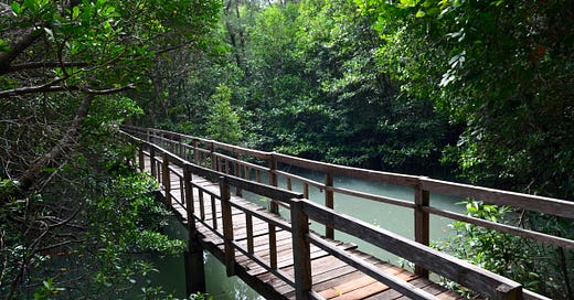
Into the green on Ko Tarutao’s remote east coast.
Paradise for nature lovers
A diverse, well-preserved natural topography is what I love most about Ko Tarutao. Beaches of white sand that squeaks underfoot rim the west coast. In the north, arm-like roots of mangrove trees reach into waterways. Vertical limestone cliffs dot the coastline. A few hard-coral reefs lie off the northeast coast, with many more reefs found in crystal water out around nearby islands to the west.
Looking down the spine of Ko Tarutao.
Most impressive of all might be the interior mountains cloaked in virgin jungle. In fact, Ko Tarutao is one of only three Thai islands with peaks that reach above 700 meters. Clear water gushes down boulder-strewn stream beds. King cobras, hornbills and wild boar wander the dense dipterocarp forests. Sea otters sometimes frolic on the coast. Stay long enough and you might even spot an island flying fox.
Much more common are the hermit crabs — and the crab-eating macaques that love to pillage unzipped tents for potato chips and Oreo cookies. Overhead, brahminy kites and white-bellied sea eagles glide in search of fish.
High five.
A pioneer of Thai marine parks
Also covering most of the Adang archipelago and the stunning islands of Ko Khai (Chuku) and Ko Klang (Tanga) located 20 to 70 km further west, as well as 21 islets and specks dashed around Ko Tarutao itself, Mu Ko Tarutao Marine Park was the first of its kind to open in Thailand back in 1974. In the context of natural conservation in the country, that might as well be the stone age.
The park’s successful establishment served as a model for the 20+ other Thai marine parks which followed. Well before that could happen, a group of park rangers narrowly escaped an attack by armed dynamite fishermen when a helicopter buzzed in to rescue them off Ko Adang — or so the story goes. Their risky work paid off when the park received ASEAN heritage status in 1984, although a bid for UNESCO natural world heritage status fell short in 1990, due to degraded river systems.
Even along the island’s only roads, signs of human life — like this lonesome spirit shrine — are scarce.
Back in those early days, most of the families that lived on Ko Tarutao relocated peacefully to the mainland, leaving some of their cattle behind. Now grazing as wild animals, distant offspring of these cows still roam freely today.
Apart from a few overgrown trails and mossy concrete lanes that cut from the north down to the east and west coasts, the island’s interior belongs to only flora and fauna. As for human inhabitants, a few Urak Lawoi fishers join park staff and the trickle of tourists who visit when the park is open from November to May.
In 2013, journalist John Sparks uncovered a secret prison in the south of Ko Tarutao, where human traffickers were holding Rohingya migrants for ransom after promising them safe passage to Malaysia or Australia. His report helped lead to the discovery of more secret migrant prisons in Southern Thailand.
A lone fisherman returns to Ao Phante Malacca.
Cabin or tent?
To reach the island, visitors are momentarily swept up in the large-scale tourism traffic departing from the same pier in Pakbara that services speedboat ferries to Ko Lipe, a couple of which can drop travelers at Ko Tarutao. Last time I visited to update the Travelfish guide in 2018, only myself and a Dutch backpacker, Noah, hopped off a boat that carried around 50 Lipe-bound passengers. Many of them appeared baffled as to why, and where, the ferry was docking for a few minutes.
Upon arrival at Ao Phante Malacca in the north of Ko Tarutao, the two of us coughed up 200 baht for national park tickets and proceeded to the visitor center. The woman working the counter there spoke little English, so I began to translate a few of the Dutchman’s questions. Before I knew it, a French family and a German man emerged behind me, asking if I could translate their questions as well.
The pier where nearly all visitors arrive at Ao Phante Malacca is rarely crowded.
Question: “How much for a tent and where can I set it up?”
Answer: “400 baht per night, not including bedding which costs a little extra. You can pitch it anywhere on the seafront field near the cold-water bathrooms, or further down the beach if you don’t mind a walk back to the facilities.”
Question: “How much for a private pick-up truck ride down to Ao Son?”
Answer: “600 baht for two hours, but they’re booked up today. Come back tomorrow.”
Question: “How much for a longtail boat trip to Ko Khai?”
Answer: “I think about 4,000 baht for a full day, but you should walk down to the riverbank and ask the boat drivers yourself.”
Question: “Is it possible to rent a motorbike to get around?”
Answer: “No. Bicycles only.”
My cold-water bathroom was already occupied by this fella. Also note the broken towel hooks.
Eventually I paid 250 baht for a mountain bike rental and 600 baht for a private room in a duplex cabin with a big porch out front. Inside, I appreciated the many screened windows and ceiling-mounted fan, but not the rock-hard bed or the absence of electrical outlets (it was possible to charge my phone at the visitor center).
After a flavorful tom yum kung and wok-fried morning glory with rice in the canteen pavilion, I strolled the 100 or so meters to the beach. In the shade of an umbrella tree, Noah sat strumming his ukelele with a pair of new friends. Even at the busiest of times, Ao Phante Malacca is a place where I’ve always encountered just about everyone else who is staying overnight during my first day there.
The beach at Ao Phante Malacca, with Ko Tanga (Klang) and Ko Adang visible to the far right.
A view and a “crocodile cave”
A 114-meter limestone massif, Pha Tobu, overlooks park headquarters at Ao Phante Malacca, affording a lay of the land after a climb. The temperature seemed to drop by several degrees as I stepped beside the natural karst walls and began ascending steps shrouded in leaves wider than me. At the top, I enjoyed the breeze while looking north towards the river and south into the interior wilderness.
The view northwards from atop Tobu Cliff.
Afterwards, I rented a kayak and began the hour-long paddle to Tham Chorakkhae (Crocodile Cave). Fish appeared in the emerald water as egrets plunged their long beaks into the mud. While the cave was only marginally impressive compared to other karst caverns that I’ve visited in the area, the ride there was a tranquil one. Saltwater crocodiles once filled the cave, but sadly they have gone extinct throughout Thailand. It does host plenty of bats, however.
Into the dark and watery Tham Chorrakhae.
An exhausting bike ride
In the morning I requested an extra pour of instant coffee and a fried egg atop my chicken fried rice — fuel for a long and tiring bike ride down to Ao Talo Wao on the east coast. I tried to take it easy on the bike because, on a previous trip, a pedal fell off and I had to walk the bike for an hour before a ranger happened by to help. Thankfully, this bike looked a lot sturdier and it did not let me down.
Down the mountain lane.
It was only a 16 km ride but the hills hit almost immediately — and that was before a grueling push over the top of a mountain. It was one of those rides where, as soon as you think you’ve reached the top, another long and steep uphill stretch awaits around the next corner. I paused often to catch my breath and listen to the birdsong, spotting lizards in the roadside brush. A wild boar ran past, letting out a squeal.
Finally the lane began to descend and from there I had a breezy blast cruising down to the coast. Arriving at the bay, I hopped off the bike to photograph the vertical karst speck of Ko Mak Lot, which towers offshore near the end of a pier that gets little use. A wee ranger station is found at Ao Talo Wao, but no one was stationed there on this day and no drinks or food were being sold. You would not want to pedal all the way down here and have no water left for the return trip.
Scoping the east coast with Ko Klang to the left and Ko Mak Lot at center.
The prisoners of Ao Talo Wao
From 1937 to 1948, this remote corner of the island contained a prison camp where some 3,000 convicted criminals toiled. Several old prison structures now sit derelict and overgrown alongside a brick footpath dotted with statues of angry-looking prisoners. Along the way, several faded yet notably detailed info boards explain different aspects of the prison, and its harrowing history.
I don’t think “basking in the sun” was the right choice of words.
The signs explain how prisoners and guards turned to piracy after being abandoned during World War II, a story that I’ve written more about for Travelfish. They looted and destroyed some 100 ships in the Straits of Malacca, killing as they went until the British Navy finally defeated them after the war.
Roughly 1,800 of Ao Talo Wao’s prisoners died in total, many from malaria and a few from snake bites. Along the trail, a spirit shrine and snaking vines contribute to the eerie atmosphere. Only forest sounds accompanied my walk.
What’s left of the prison “clubhouse” beside the Ao Talo Wao historical trail.
While common criminals were kept at Ao Talo Wao, political prisoners were held at Ao Talo Udang near the island’s southernmost point. One of them was Sittiporn Gridagorn, a son of King Rama VII who helped attempt a failed coup after the absolute monarchy was ended in 1932. Sittiporn survived the ordeal and, after a pardon, became Thailand’s minister of agriculture, a role partly earned through his development of a new cucumber strain while doing time on Ko Tarutao.
The story of Ko Tarutao’s prisons was adapted into a highly sensationalized Thai-language film, Narok Tarutao (meaning “Hell of Tarutao”), released in 1976. I’ve yet to find a copy, but this review makes it sound pretty damn gruesome.
You won’t find vicious sharks around Ko Tarutao nowadays. (Source: Film Affinity)
Solitude at Ao Son
After a day spent at the beach recovering my aching thighs, I felt (barely) up for another long bike ride down to the distant west-coast beach at Ao Son and a nearby waterfall. This one started out the same as my ride to Ao Talo Wao, but, instead of going straight up the mountain after the first few km, I hung a right and stopped at the cabin and camping zone that overlooks the khaki sand of Ao Molae.
Though not as challenging as the ride to Ao Talo Wao, this eight-km journey delivers its share of steep hills as well. The good news is that cold beverages are sold at both Ao Molae and Ao Son, where camping is possible.
An unusual Chinese-style spirit image set up somewhere behind Ao Son.
Measuring nearly five km in length, Ao Son is the longest beach in the marine park. The sea hides most of its sand when the tide is up, but low tide reveals an expansive carpet of packed sand. I kept thinking that I saw people far ahead while strolling beneath a heavy midday sun. By the time I reached those objects, however, I found nothing but big chunks of driftwood. I’ve never spotted another soul on Ao Son.
Yet someone did appear to be returning fairly often to leave offerings at a gold-painted spirit shrine set back in the shade of a banyan tree somewhere near the center of the beach. Dusky leaf monkeys swung in the nearby treetops, their white faces peering down at me from high up in the canopy.
Nothing but me and this helmet-wearing piece of wood.
One last stop at Ludu Waterfall
On the way back I parked the bike and ventured down a three-km trail with several stream crossings that had been more adequately marked since my first time hiking here in 2011, when I briefly lost the way and freaked out a little. On the final stretch up a rocky stream bed, I stopped to check out the orange and ocher mushrooms sprouting from a fallen tree that has become a footbridge for hikers.
Dry season shadows on the way to Ludu Waterfall.
More of a refreshing swimming hole than a proper waterfall, Ludu is worth a visit primarily to experience the old-growth jungle of Ko Tarutao up close.
Upon arrival I found a middle-aged Swedish couple taking a swim, and I grabbed a seat on a log to chat with them for a few minutes. They seemed to be enjoying having this secluded paradise to themselves, so I scrambled over more boulders and found my own solitude a little further up the stream bed. Though I came across no pools as deep as the one at Ludu, several were ideal to dip my feet in for a free fish spa.
Serenity.
Plenty more to see
While I’ve visited Ko Tarutao three times since 2011, there’s still plenty left to explore. One spot that I’m eager to hit for the first time is Ao Talo Udang, where I’ve heard that some of the 80-year-old remains of the political prisoner camp can be seen. As for the rest of Mu Ko Tarutao Marine Park, I’ll dig more into the Adang archipelago side of it in another issue of Island Daze down the road.🌴
Amazing article. Truly. I can't wait to read more.
Last December I was a Lipe-bound tourist who watched with curiosity as a couple of trekkers hopped off the speedboat at Ko Tarutao. I marked it on my map at the time and have wondered ever since. Thank you for your detailed descriptions of a paradise I hope to explore one day.