Intro to the Thai Island & Coastal Directory
800+ islands. Seven coastal zones. One directory.
Welcome to Thai Island Quest (formerly Thai Island Times), and thank you for reading.
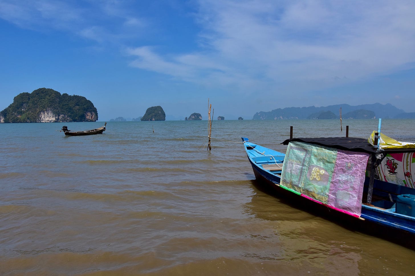
Eyes squint through salt.
Warm seawater sprays the boat.
A hornbill glides into trees.
In a beach shack, a song plays.
The air cools and rain falls over the sea.
Boat drivers laugh.
The smell of roti is in the air.
Old friends clinking beer bottles.
Toward sunset, a boat drifts.
Twilight arrives and so do the crabs.
This is a taste of the imagery that comes to mind when I think over times I’ve spent along Thailand’s roughly 2,800 km of coastline, and its many islands, over the last 15 years. The beaches in my memory seem to go on forever.
But I had never compiled virtually all of the places where these fond memories originated — and then some — into a single guide.
Until now.
It’s called the Thai Island & Coastal Directory, and if you love this part of the world even half as much as I do, then I reckon you’ll enjoy this broad vantage of Thailand’s islands and shorelines. Useful, I think you’ll find it as well.
Why a Thai Island & Coastal Directory?
Because I’m a little nuts, for one.
As far as I know, the T.I.C.D. will be the most complete guide to Thailand’s islands and shorelines ever written in English. It will serve as handy intelligence for casual travelers, island lovers, expats and even sailors. In fact, a draft version of this very Directory is what I’ve been using to guide my own travels for years. It is the foundation of Thai Island Quest.
A bit of background
Over the last 11 years I’ve spent countless hours pouring over maps and other resources while comparing them to what I’ve seen and learned first-hand while traveling for both work and fun. I’ve pestered many locals by pointing at some rock offshore and asking, “What is that island called?” I’ve routinely gone out of the way to simply lay eyes on and snap a photo of this or that island from afar.
I do not claim to have set foot on anywhere close to every island that is included in the T.I.C.D., but I am attempting — albeit at a tortoise’s pace these days — to visit as many Thai islands as I can. (Now I’m at around 80, which includes stops in nearly every island group.) For me, the Directory is a blueprint of islands that I still intend to reach, and a review of islands I’ve already covered.
My first attempt to make sense of all the Thai islands in a single writing project came through a 6,000-word piece for Travelfish that Stuart McDonald (Travelfish’s co-founder) dubbed, “the definitive guide to the Thai islands.” That was in late 2018, and it was one of the itinerary articles that capped off my eight years as a full-time Travelfish writer, covering, in large part, Thai islands and beaches.
A year later, working on my own, I condensed every Thai island I knew of into a Word document. From that effort, the T.I.C.D. was born.
Since then I’ve added quite a bit, including key points on the mainland coasts. I fully intend to keep polishing and improving the Directory in the future.
Does it really include every island in Thailand?
Covering every single Thai island is indeed a goal of the T.I.C.D..
It certainly includes every saltwater island that I’m aware of after years of obsessively researching the Thai islands. I’m sure that I’ve missed a few piles of rocks here or there, but I’m confidant that my Directory specifically mentions the vast majority of Thailand’s sea islands. And not only the inhabited ones or those that are popular with tourists, but also the country’s many obscure islands as well.
In addition to 800+ islands, the T.I.C.D. covers mainland coastal areas in a way that I hope will give readers a sense of how the islands geographically relate to the mainland, including brief but useful info, like where you might find boats to a given island, or what is the nearest major transport hub.
And yes, the Directory does cover many wee islands that I call “specks,” maybe big enough for a few people to stand on while swinging a cat. Hey, some of these tiny islands are more interesting than you might think, especially if you’re willing and able to put on a mask (and maybe a tank) and dip below the surface.
How is it all arranged?
Starting late December 2022, I’m gradually publishing eight chapters, seven of which focus on one of Thailand’s seven coastal zones that I explained in two introductory articles from 2020: ‘Making sense of ALL the Thai islands’ and ‘The many shapes and sizes of Thailand’s islands.’
Here are those seven zones again:
Eastern Gulf: Ko Chang, Ko Mak, Ko Kut, Chanthaburi, Ko Samet, etc.
Upper Gulf: Ko Si Chang, Ko Larn, Pattaya, Hua Hin, Khao Sam Roi Yot, etc.
Mid-Southern Gulf: Ko Samui, Ko Phangan, Ko Tao, Mu Ko Ang Thong, etc.
Deep Southern Gulf: Songkhla Lake, Sathing Phra, Pattani, Narathiwat, etc.
Northern Andaman: Ko Phayam, Ko Surin, Ko Similan, Khao Lak, etc.
Central Andaman: Phuket, Ao Phang Nga, Ko Phi Phi, Krabi, Ko Lanta, etc.
Southern Andaman: Ko Tarutao, Ko Lipe, Ko Bulon, Ko Mook, Ko Rok, etc.
Each chapter shakes the islands and shorelines in each of these coastal zones down roughly into the provinces and national parks that administer them, as well as into Thailand’s archipelagos and island groups. Islets, specks and some small islands that I think of as “satellites” of larger islands are presented as such.
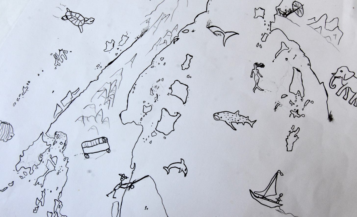
The T.I.C.D. also features at least seven of my own hand-drawn maps to help you visually understand what you’re reading — or at least get a good laugh about my art skills. Many photos also appear, most of them taken by yours truly and with a few guest photos for the islands I’ve not yet visited.
The maps include labels of as many islands, beach areas, capes, bays, estuaries, cities, towns and mountainous areas as I can squeeze in. They also have color-coded “stamps” to indicate mass tourism, urban area, national park area, and major ferry pier. From there, using the additional info or “tags” described below, you’ll be able to single out specific areas that might fit your style and interest — and begin to see how they might fit into the flow and logistics of a trip.
More than just a list
In 2019, my original 25-page draft directory only included names of the islands, insofar as I knew them, and a few words relating to the location, accessibility, topography and inhabitation of each. From there, I added many tags — a descriptive word or phrase conveying key info, such as whether an island is inhabited, or is heavily developed, or is a dive site — to every island in the list.
To make it easy for you to understand a bit about all 800+ islands and beach areas, more than 200 different tags employed. I won’t unveil every one of them now, but I will tell you that they all fall into these categories:
Alternative spelling(s) & map shape
Size & status
Location & accessibility
Transportation
Topography
Inhabitation
Warning(s)
Facilities
Vibe
Activities
Look for
And here are some examples of the actual tags used:
Family-friendly
Young party scene
Minimal nightlife
Expect limited or no English to be spoken
Illegal to go ashore
Notably popular with domestic travelers / retirees / long stayers
Primarily resort food
Expat scene
7-elevens
Day trips only
Close-knit
Mass tourism
Low-level tourism
Mainstream tourism
So you’ll find out in the Thai Island Directory that Ko Kradan, for example, is a snorkeling site with great beaches, along with other basic info. Other Thai Island Quest content, such as this feature on Ko Kradan from 2021, will deepen your knowledge of the island.
Money matters
Starting December 28th, 2022, all subscribers (free and paid) started receiving the first chapter of the T.I.C.D., on the Eastern Gulf of Thailand, in postings (i.e. emails) — and that chapter is now complete. Moving forward, only paying subscribers get the other six chapters as they are released at a speed of roughly four postings per month. That is on top of other Thai Island Quest content.
Paid segments of the T.I.C.D. come as part of the four monthly posts, minimum, that I guarantee to paying subscribers of the newsletter. In addition to the entire chapter on the Eastern Gulf, free subscribers receive previews of all other chapters / sections to go with all sections found in Chapter 1 of the T.I.C.D., including a forthcoming overview of environmental concerns in coastal Thailand.
Once the entire Directory is complete, I intend for it to be available online at Thai Island Quest, and in a PDF book form.
Confused?
Don’t worry — you can see all previously chapters of the Thai Island & Coastal Directory at the Table of Contents and the TIQ welcome page. The quest is on. 🌴
Thanks for reading Thai Island Quest (formerly Thai Island Times), an independent, reader-supported e-newsletter sharing the beauty, challenges and distinctive identities of Thailand’s islands and coastal areas. Yes, all of them.
Copyright, David Luekens: All rights reserved.




Popular for retirement versus Expat scene is an interesting distinction, David, but I think I understand the difference. Love the Mermaid just south of Samet in your drawing. A reference to the one at Ao Phai? Cheers.
really looking forward to this, David! and thank you again, not only for your comprehensive knowledge of Thailand's islands, but for your kindness you have displayed to me! ❤